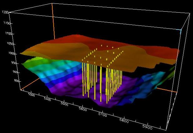
The ice surface and bedrock surface beneath the Worthington Glacier, Alaska. Resolution of both surfaces is 20 x 20 m. Yellow lines indicate the positiond of boreholes used to measure ice deformation.
Updated: August 03, 2011
© 1998, Brian C. Welch,
Univ. of Wyoming