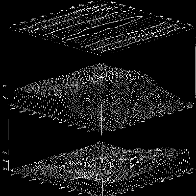
 Contour and mesh surface map of Siple Dome between Ice Streams C and D in West Antarctica. |
The contours in the upper panel represent the surface topography of a 10 Km square region centered on the summit (see our satellite image). The lower mesh surface is bedrock topography as determined from surface-based ice-penetrating radar measurements. Between these is a mesh surface depiction of one of the more prominent internal layers produced by radar reflections from (probably volcanic) debris. This layer is interesting because it depicts the strain field within the ice, and it thus contains information about both the accumulation history in the area as well as ice dynamics. |