|
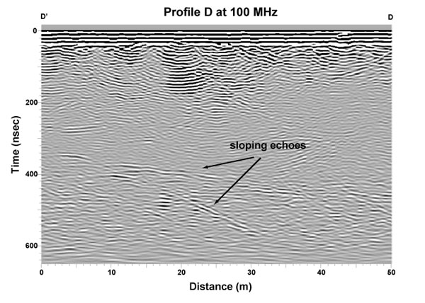
This figure shows a migrated section of profile D-D' at 100 MHz, part of a grid survey from a region near the valley center
line. Click here for a map of
the glacier and profile routes. Ringing in the upper portion of the record is produced by the copious amounts of water at the surface. Beneath this is a zone of relatively cold echo-free ice ending at about 30 meters depth. Within the warmer ice below are returns from two sloping echo sources, one extending nearly the full width of the profile and the other dipping more steeply. Both of these sloping echoes are present in adjacent profiles parallel and perpendicular to the one shown, and thus an approximate orientation for the source could be inferred in three dimensions.
To analyze data in the field and coordinate efforts with the drilling program, we developed software to view adjacent profiles in these grids as sequential frames in a 'movie,' enabling us to simulate a three-dimensional view of the ice. Locations with echoes suggestive of linear englacial features were further surveyed to provide coordinates for the drill team.
Drilling at this particular location intersected an air-filled cavity that was subsequently investigated with bore-hole video.
|