|
|
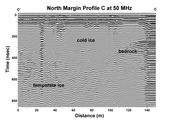
The bedrock echo clearly present in the cold ice at the right of the figure slopes downward to the left and disappears into echoes from within the deeper temperate ice zone. Energy at this frequency is scattered from water bodies within the temperate zone and as a result the bedrock echo becomes obscured. Echoes starting at the surface toward the left side of the profile in two locations are from drilling equipment and a cable down one of the bore holes. Another at ~110 m is due to a water-filled crevasse, and a surface slush layer produces copious ringing at the right. A series of bore holes were drilled at this location, several of which connected to an englacial water system above the bed. However, none of these connections could be unambiguously identified with echoes in the radar surveys. |