Western Mongolia
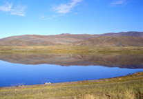
Western Mongolia is a rich mix of desert-steppe, steppe, forest-steppe, and taiga ecosystems which have been grass dominated over the past ~4000 years. Elevation in the area ranges from ~750 to 2800 meters above sea level and annual precipitation ranges from <100 to over 300 mm/yr.
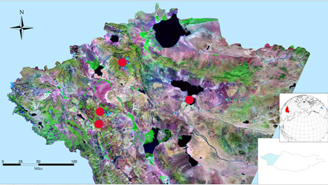
Above is a satellite based composite image (MrSid) of western Mongolia study area. Green areas are generally more productive than purple areas. Black shapes are lakes and dots represent lakes where ~1m long surface cores were taken.
Western Mongolia is an ideal region to examine linkages between climate and fire because of a mix of vegetation types and different fuel loads, a large number of lakes that serve as potential sampling sites, and a high degree of climatic sensitivity due --in part -- to its location at the margin of the summer Asian monsoon.
The principle objective of
this research is to document changes in climate and fire over the past
2000 years (based on preliminary carbon dating) in western Mongolia as
a means of testing hypotheses linking vegetation productivity and burning.
Charcoal extracted from lake sediments is used as a proxy for fire, sediment
magnetics and organic matter content as a proxy for local environmental
and climatic change and similarily biogenic silica and phosphorus are
used as proxies for change in the lakes and surrounding upland areas.
Analysis is on-going.
This work was done as part of an expedition to western Mongolia to survey the biodiversity and geochemistry of lakes. It was organized by researchers at the Science Museum of Minnesota St. Croix Research Station, and the fire, charcoal, vegetation described in preceeding paragraph was supported by NSF ROA supplement DEB 0431529 to BS&I award DEB 0316503.